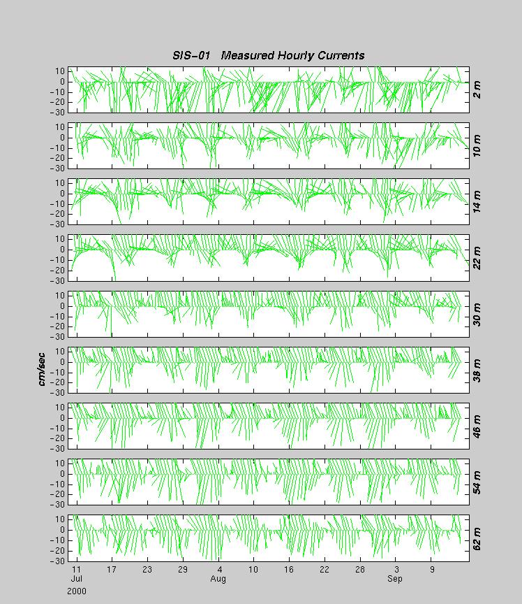
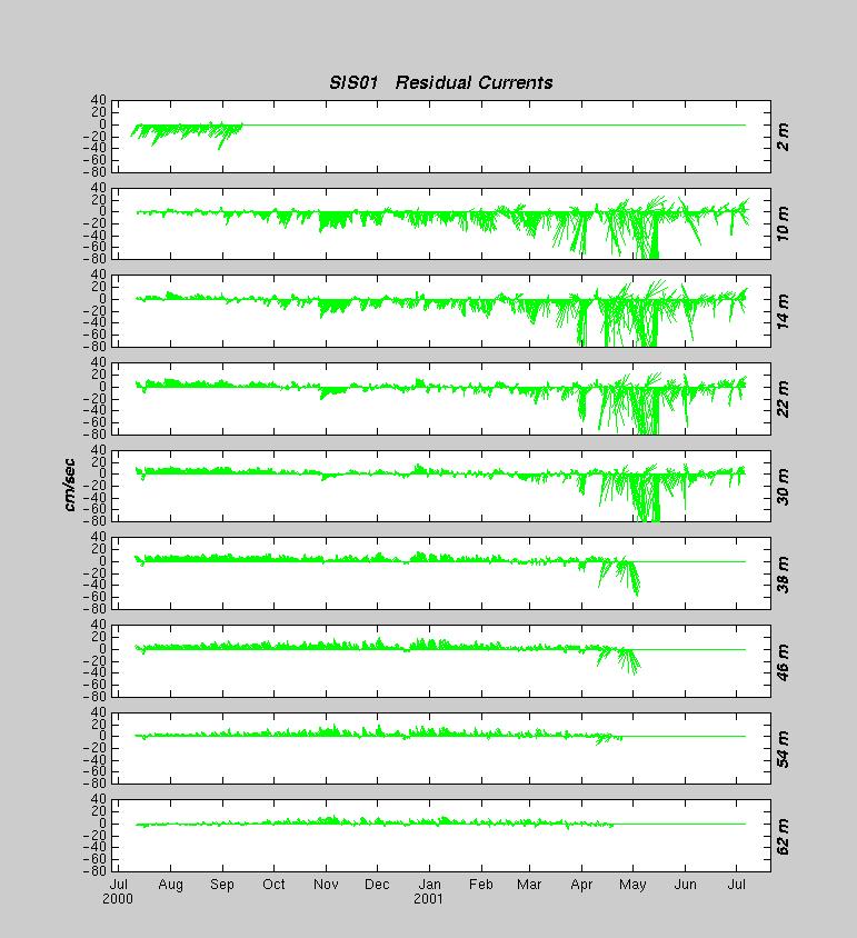
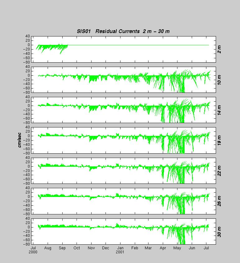
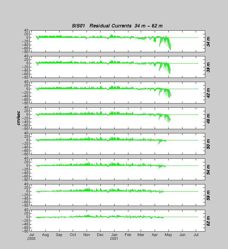
SIS-01 was deployed on 10 July 2000 at 44° 03.32´N and 069° 01.13´W,
outside of Rockland Harbor, to the west of WPB-04. The water depth was approximately 65 meters. The ADCP shows 14
good bins with the deepest bin centered at 62 meters. The data logger stopped
transmitting data in mid-September but data from the instruments were retrieved
after the mooring was recovered.
Mooring Information:
Deployed: 10 July 2000 at 1805 UTC by the
R/V ARGO MAINE
Latitude: 44° 03.32´N
Longitude: 69° 01.13´W
Depth: 65 m
Light List: B
Recovered: 7 July 2001
Comments: Very heavy fouling of near-surface instrumentation
Instruments:
300kHz RDI Acoustic Doppler Current Profiler S/N 617, 4-meter bins. Lower bins
started to fail in April/May 2001.
FSI 3D-ACM S/N 1608. Instrument failed during deployment (erratic currents)
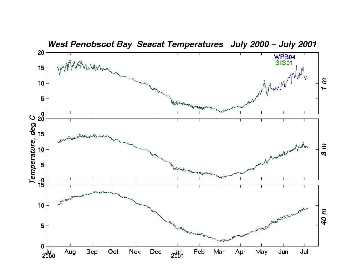
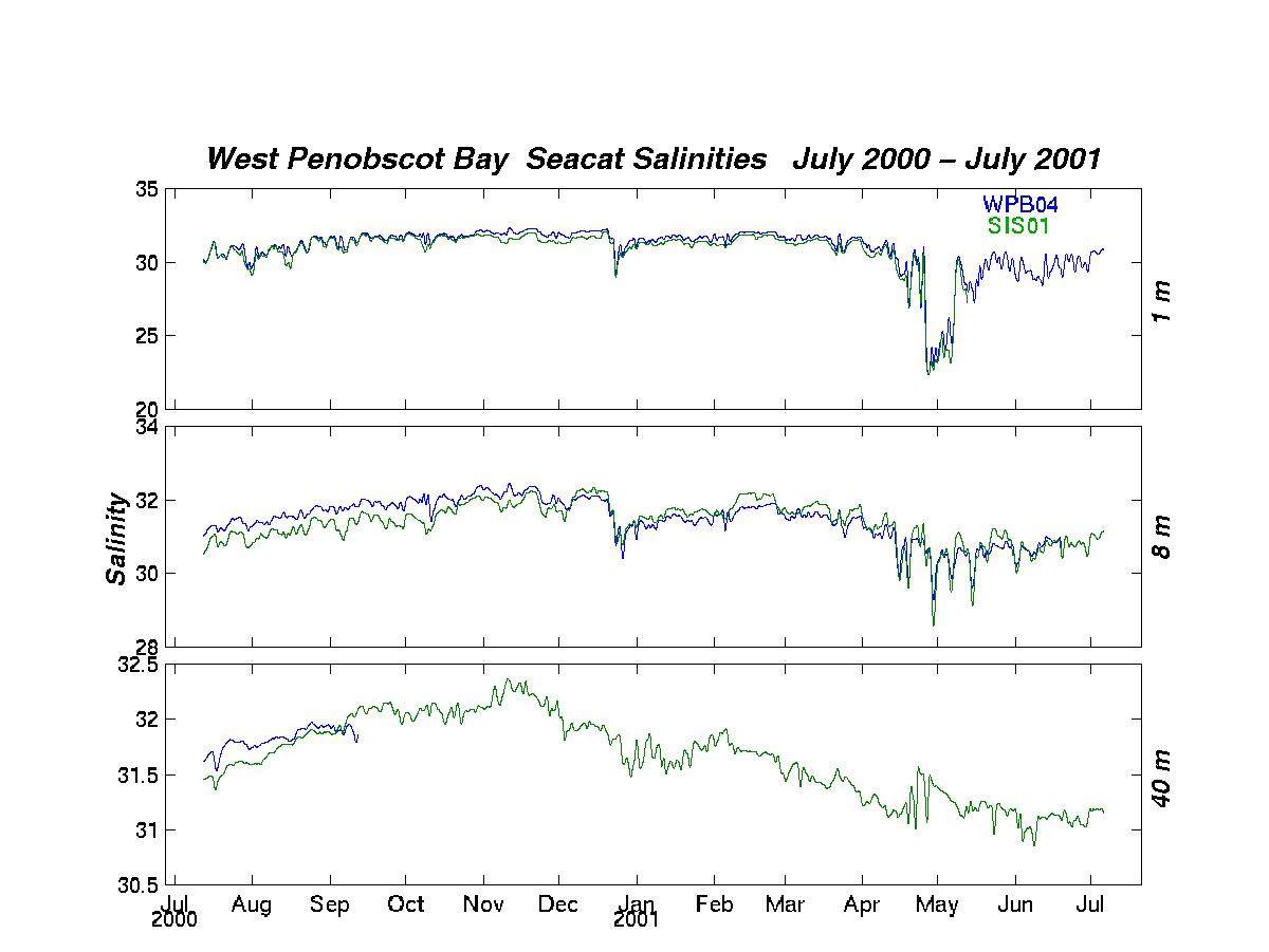
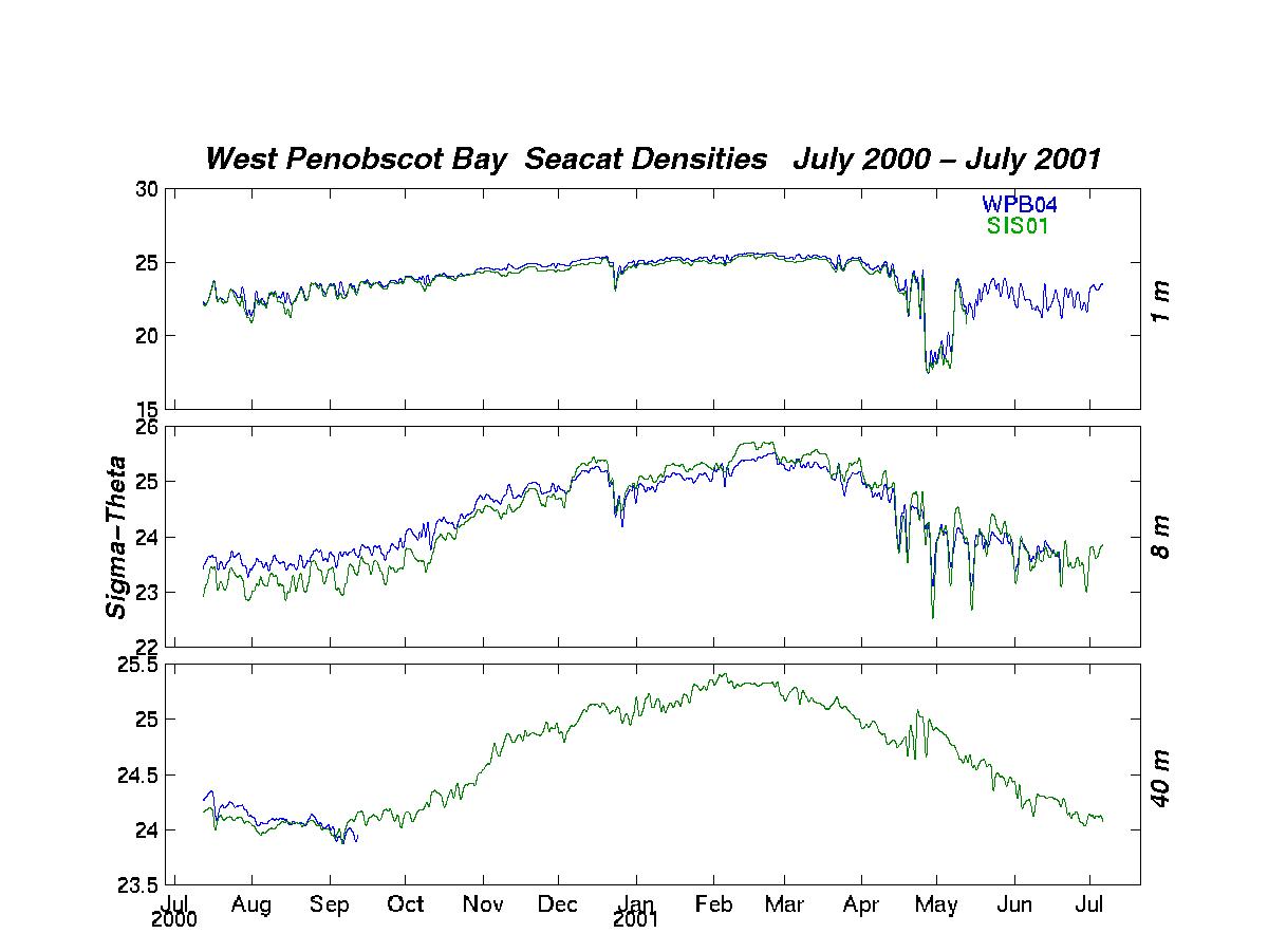
Seabird SBE-1603 Seacats at 1 m (S/N 1569, data ended May 2001), 8 m (S/N 1925, and 40 m (S/N 1926).
Data were recorded internally.
Data Plots:
Measured Currents: hourly averaged and rotated to true north, 4-meter bins from
2 meters to 62 meters

