

| Quick Looks at Gulf of Maine Realtime Data: | ||
| Rollover Map : Latest Hourly Data | ||
| Plots: Regional Surface Conditions from Gulf of Maine stations | ||
| UMOOS Buoy Text Listings:: Last 10 days or Yearly (by site) | ||
| List of Active UMOOS Buoys : Realtime netCDF files or Historical netCDF files | ||
| Funding Partners: |
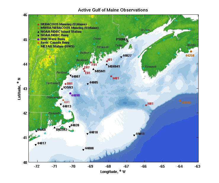
Active Mooring Sites
| Site | Location | Start Date | Latitude | Longitude | Mooring Status | Light List Letter | Light List Number |
|---|---|---|---|---|---|---|---|
| A01 | Massachusetts Bay | 2001-07-10 | 42° 31.39´N | 070° 33.98´W | 2025-07-31 | A | 367 |
| B01 | Western Maine Shelf | 2001-07-09 | 43° 10.76´N | 070° 25.60´W | 2024-12-15 | B | 113 |
| E01 | Central Maine Shelf | 2001-07-09 | 43° 42.92´N | 069° 21.33´W | 2026-05-02 | E | 30 (4935) |
| F01 | Penobscot Bay | 2001-07-08 | 44° 3.28´N | 068° 59.78´W | 2026-05-01 | F | 4052 |
| I01 | Eastern Maine Shelf | 2001-07-24 | 44° 6.14´N | 068° 6.77´W | 2025-07-30 | I | 2296 |
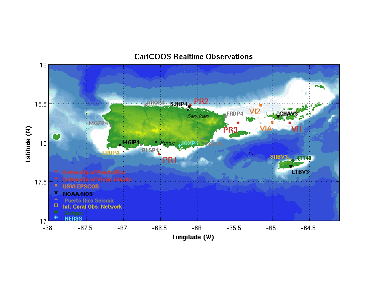
| PR1 | CarICOOS Data Buoy A | 2009-06-09 | 17° 52.20´N | 066° 32.22´W | 2024-07-31 | A | 31941 |
| PR2 | CarICOOS Data Buoy B | 2010-07-23 | 18° 28.46´N | 066° 5.97´W | 2024-08-12 | B | 30737 |
| PR3 | CARICOOS Data Buoy E | 2013-09-10 | 18° 15.67´N | 065° 27.85´W | 2025-12-17 | E | 31383 |
| VI1 | CarICOOS Data Buoy C | 2011-04-15 | 18° 14.95´N | 064° 45.79´W | 2024-09-02 | C | 32566 |
Additional Information:
References:
- The GoMOOS Moored Buoy Design, J.Wallinga, N.Pettigrew, J.Irish, Oceans 2003: PDF or Word Doc file
- Buoy Metadata
- Standard Measurements on a NERACOOS Gulf of Maine buoy