Drifting Buoys, RMRP 1995
Drifting Buoys, RMRP 1995
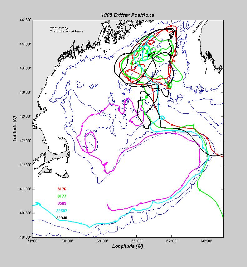
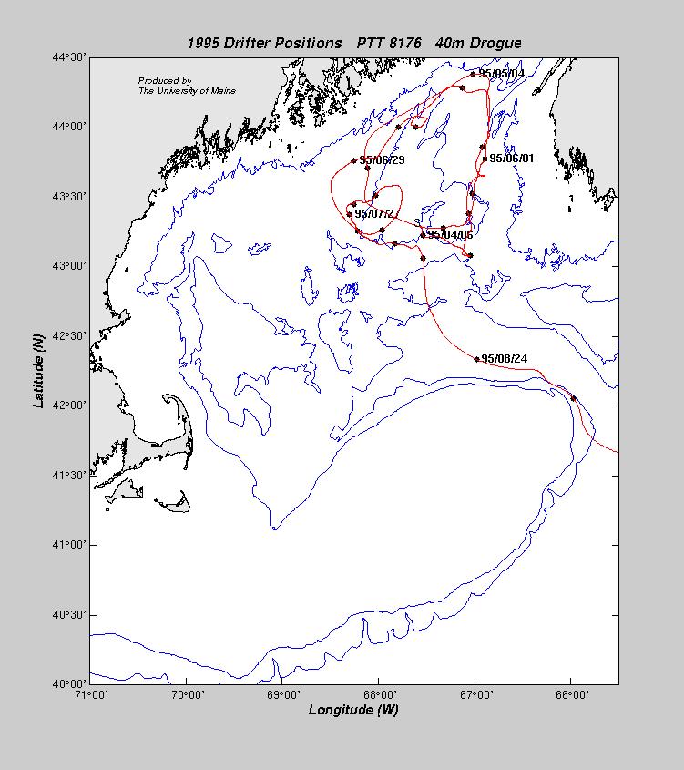
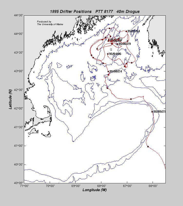
Drifting Buoy Information:
Five satellite tracked drifting buoys were deployed between 3-4 April 1995 by the RV
Argo Maine.
All five were drogued at a depth of 40 meters. The drifting buoys transmitted via Service Argos
and between 4 and 6 positions were received daily for most of the buoys. The
table below lists the deployment positions along with the date and position of
the last transmission.
Data Processing:
The positions calculated by Service Argos were edited using a default speed
criterion of 6 knots, eliminating unrealistic positons. The cleaned time series
were fit by a cubic spline and interpolated to hourly positions. The hourly
positions were low-pass filtered to remove any tidal effects.
Data Display:
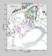
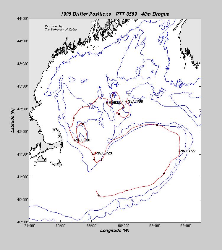
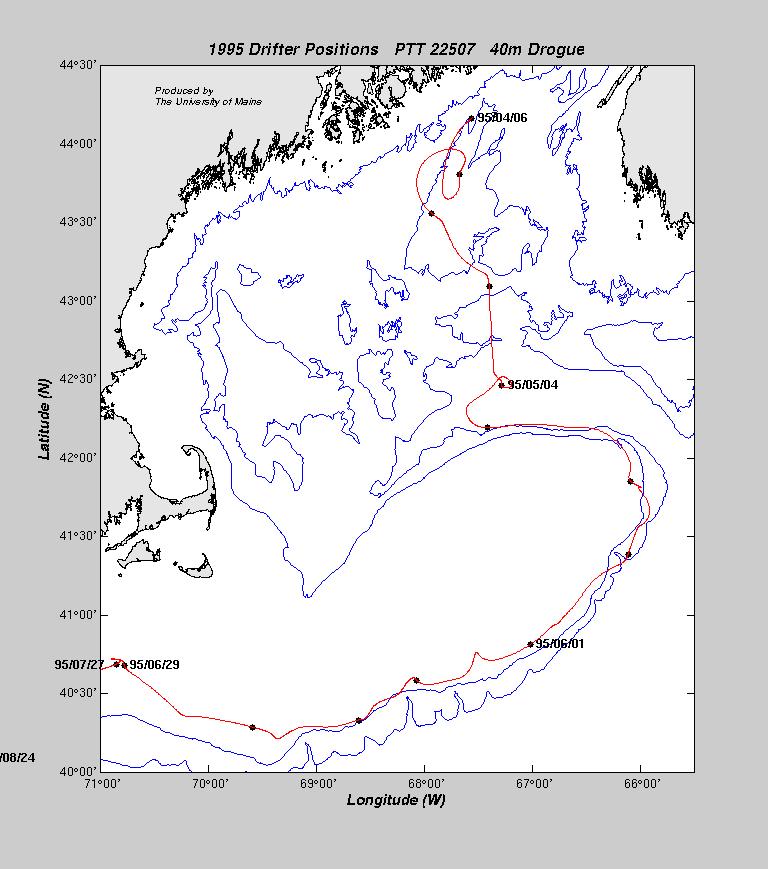
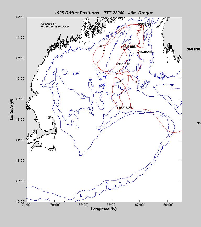
The smoothed position time series are shown for each buoy. The symbols on the
plots are every seven days, starting on 6 April 1995 at 0000z. Labels indicating
the date are placed every four weeks.
| PTT | Drogue Depth | Date Deployed | Latitude | Longitude | Last Date | Latitude | Longitude |
| 8176 | 40 m | 3 April 1995 | 43° 18.0´N | 67° 37.2´W | 31 Dec 1995 | 51° 11.6´N | 44° 59.4´W |
| 8177 | 40 m | 4 April 1995 | 43° 33.0´N | 67° 40.2´W | 31 Dec 1995 | 39° 54.5´N | 55° 28.4´W |
| 8589 | 40 m | 3 April 1995 | 42° 50.7´N | 67° 50.5´W | 08 Aug 1995 | 40° 50.0´N | 68° 58.0´W |
| 22507 | 40 m | 4 April 1995 | 43° 09.5´N | 67° 23.4´W | 30 Dec 1995 | 35° 17.9´N | 46° 05.5´W |
| 22940 | 40 m | 4 April 1995 | 43° 49.3´N | 67° 33.1´W | 31 Dec 1995 | 43° 42.6´N | 65° 21.7´W |

