

|
|
|||||

|
|||||
| Regional Surface Conditions from PR1, PR2, VI1, VI2, and nearby stations |
| Reports (last 10 days) for PR1 Surface or Ocean or Currents |
| Reports (last 10 days) for PR2 Surface or Ocean or Currents |
| Reports (last 10 days) for PR3 Surface or Ocean or Currents |
| Reports (last 10 days) for VI1 Surface or Ocean or Currents |
| Reports (last 10 days) for VI2 Surface or Ocean or Currents |
March 2013: The EPSCOR US Virgin Islands' oceanographic data buoy VIA (Light List A) was deployed on 7 March at 1500 UTC off the south coast of St. Thomas. Data from this buoy are also being sent to NDBC (ID 41051).
April 2011: The CARICOOS oceanographic data buoy VI1 (Light List C) was deployed on 15 April at 2045 UTC off the south coast of St. John (Virgin Islands) at a depth of 148 feet. Real-time data provided by this buoy will include wind measurments, air temperature, atmospheric pressure, wave informtion, near-surface water temperature and salinity observations, and ocean currents throughout the water column. This buoy is supported by the University of Virgin Islands and National Oceanic and Atmospheric Administration's (NOAA) Integrated Ocean Observing System (IOOS) office.
July 2010: The CARICOOS oceanographic data buoy PR2 (List List B) has been deployed on 23 July at 1410 UTC off the north coast of Puerto Rico near San Juan at a depth of 110 feet. Real-time data provided by this buoy will include wind measurements, air temperature, atmospheric pressure, wave information, near-surface water temperature and salinity observations, and ocean currents throughout the water column. This buoy is supported by the National Oceanic and Atmospheric Administration's (NOAA) Integrated Ocean Observing System (IOOS) office.
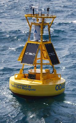
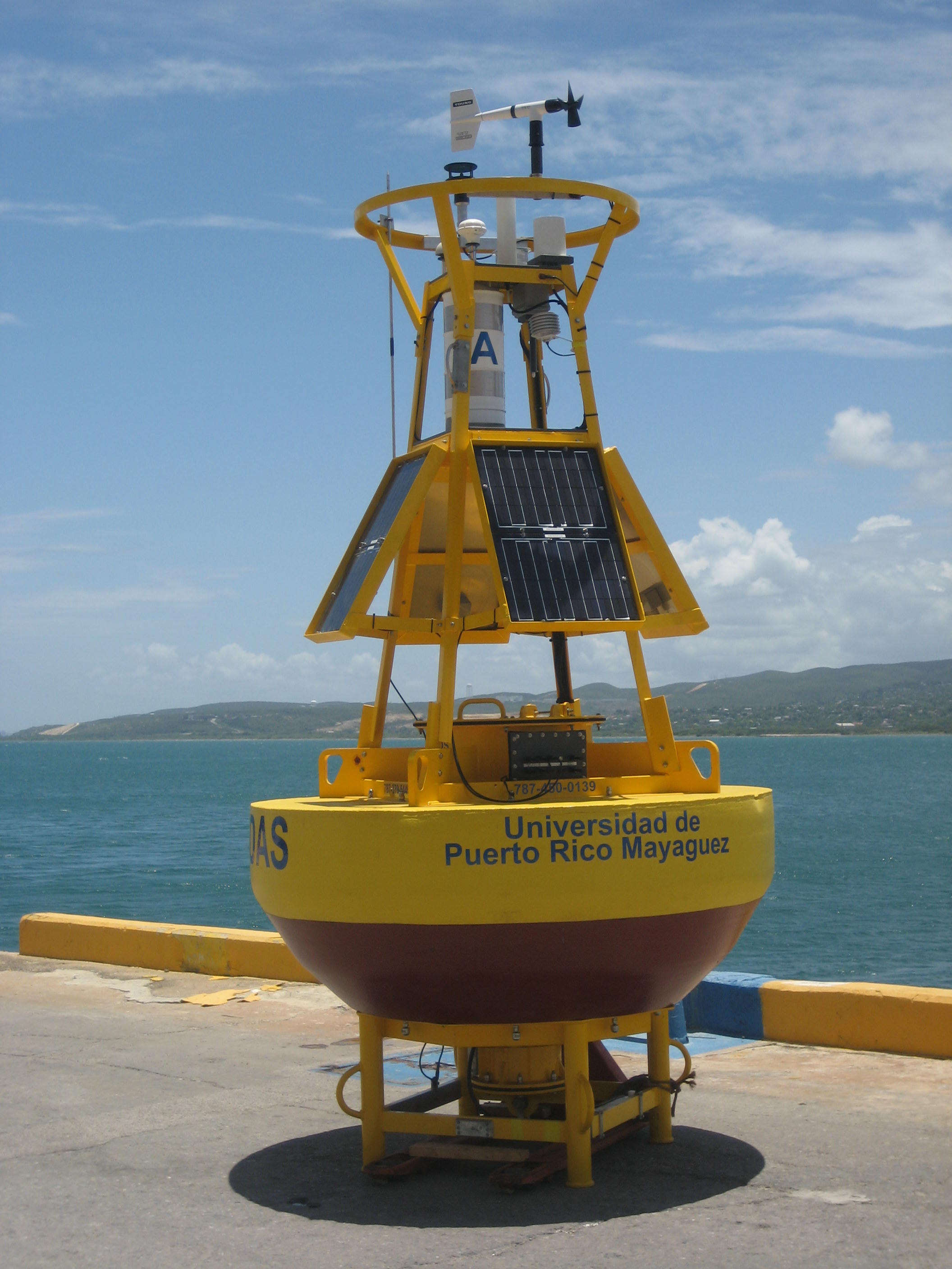
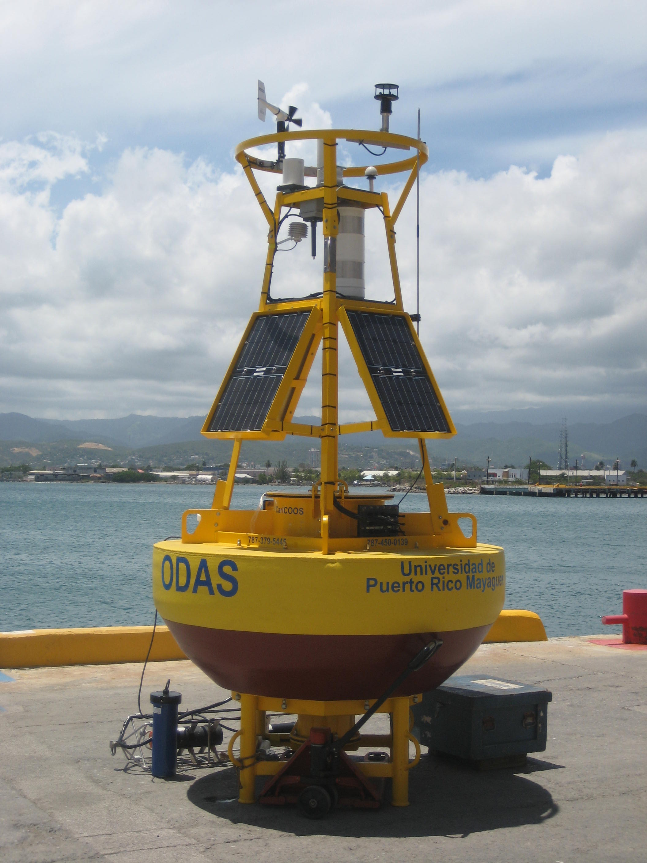
June 2009: The CARICOOS oceanographic data buoy PR1 (Light List A) has been deployed on 9 June 2009 at 1340 UTC by University of Puerto Rico Mayaguez and University of Maine personnel. It is installed on the south coast of Puerto Rico, in the vicinity of the port of Ponce, at a site 2 nautical miles south of Caja de Muertos Island at a depth of 55 feet. Real-time data provided by this buoy will include wind measurements, air temperature, atmospheric pressure, wave information, near-surface water temperature and salinity observations, and ocean currents throughout the water column. This buoy is supported by the National Oceanic and Atmospheric Administration's (NOAA) Integrated Ocean Observing System (IOOS) office.