RMRP 1994
Experiment Location
This experiment primarily focused its efforts on the coastal and near-coastal
waters of the Gulf of Maine.
Cruises:
- April 3-4, 1994 (RV ARGO MAINE)
- Moorings: COAS-1, JORD-1, and
TRUX-1 surface moorings deployed
- April 25-30, 1994 (RV ARGO MAINE)
- June 6, 1994
- COAS-1, JORD-1, and TRUX-1 moorings recovered
- November 1-8, 1994 (RV ARGO MAINE)
Moorings
Description:
The University of Maine deployed three inverse-catenary moorings, one within the 100 meter
isobath (COAS-1) and two within the 200 meter isobath (JORD-1 and TRUX-1). These
moorings were designed to sample the water column at discrete time intervals and
average the data to half-hourly values using 150 kHz ADCPs manufactured by
R.D. Instruments, Inc.
Seabird Seacat T/S instruments were attached
to the mooring wire near the surface at 3 depths on each mooring and sampled at
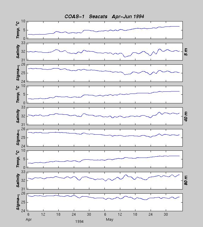
a rate of one sample every 5 minutes. COAS-1 seacats
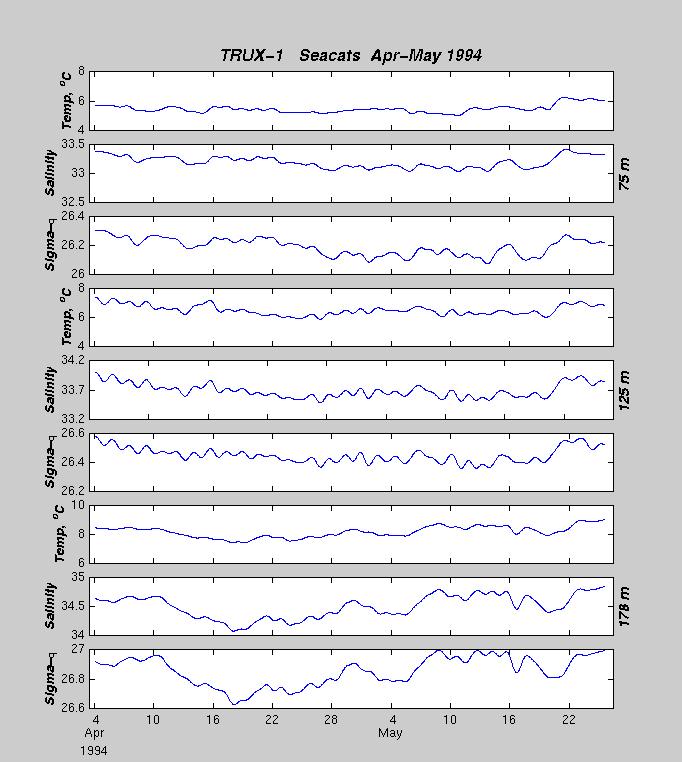
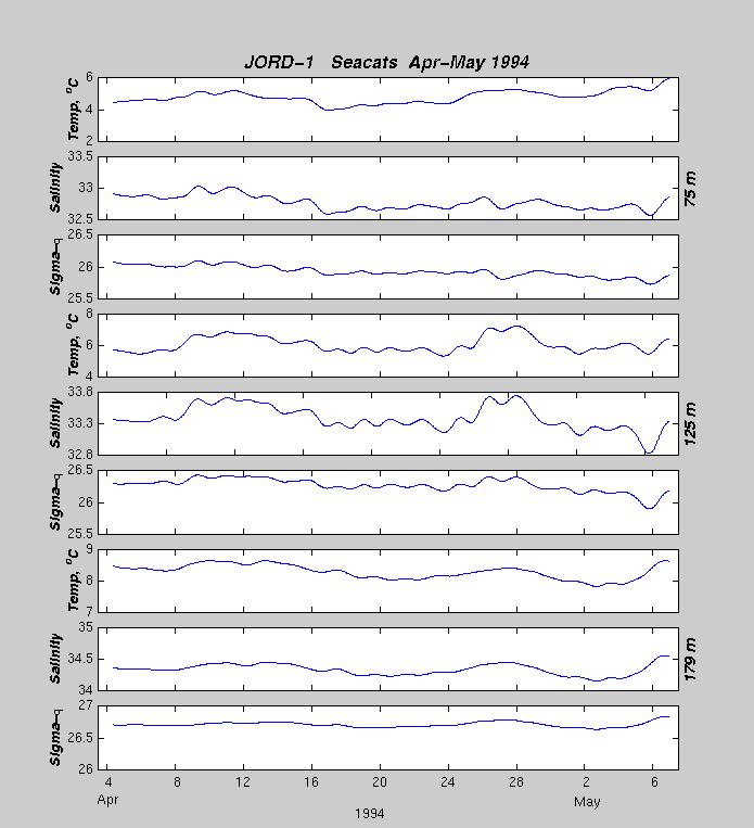
were attached at depths of 5, 40, and 80 meters. TRUX-1 and JORD-1 seacats were located
at 75, 125, and 178 meters. The moorings were deployed on the RV
ARGO MAINE
in April 1994. The
surface floats broke free on TRUX-1 and JORD-1 during the first month and were
later recovered. The FV CORSAIR recovered COAS-1 and the bottom portions of
JORD-1 and TRUX-1 in June 1994.
The mooring locations are as follows:
| BUOY |
Data |
Latitude |
Longitude |
Depth |
Deploy. Date |
Recov.Date |
Comments |
| COAS-1 |
Vel,T/S
|
44° 17.24´N |
067° 40.92´W |
94m |
03 Apr 1994 |
05 Jun 1994 |
OK |
| TRUX-1 |
Vel,T/S
|
43° 04.62´N |
067° 34.86´W |
193m |
04 Apr 1994 |
05 Jun 1994 |
Float broke free during 1st month |
| JORD-1 |
Vel,T/S
|
43° 57.17´N |
067° 44.86´W |
194 m |
04 Apr 1994 |
05 Jun 1994 |
Float broke free during 1st month |

