RMRP 1996
Experiment Location
This experiment primarily focused its efforts on the coastal and near-coastal
waters of the Gulf of Maine.
Cruises:
- April 2, 1996
- May 9-15, 1996 (RV ARGO MAINE)
- July 11, 1996
- JORD-3 mooring trawled and recovered by FV
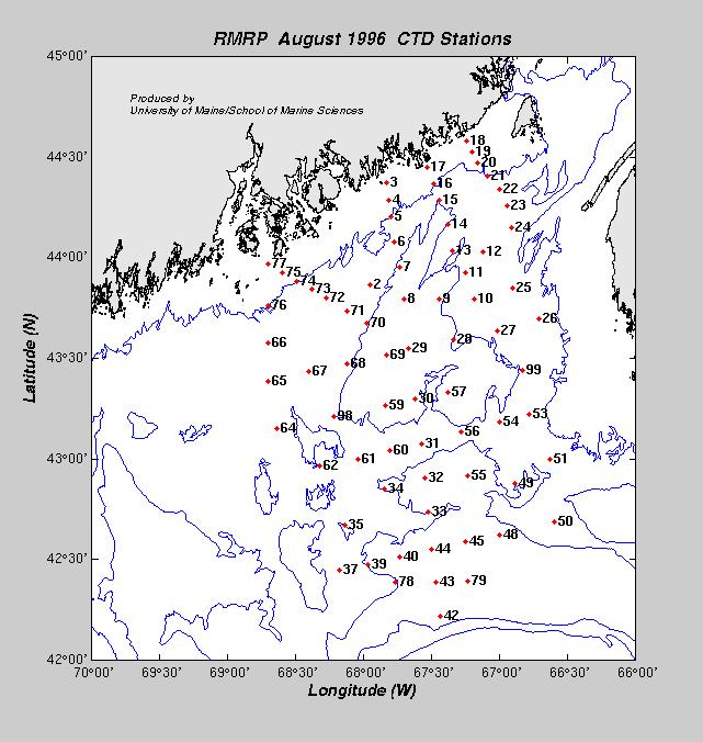
- August 6-10, 1996 (RV ARGO MAINE)
- August 7, 1996
- TRUX-3 mooring trawled and recovered by FV
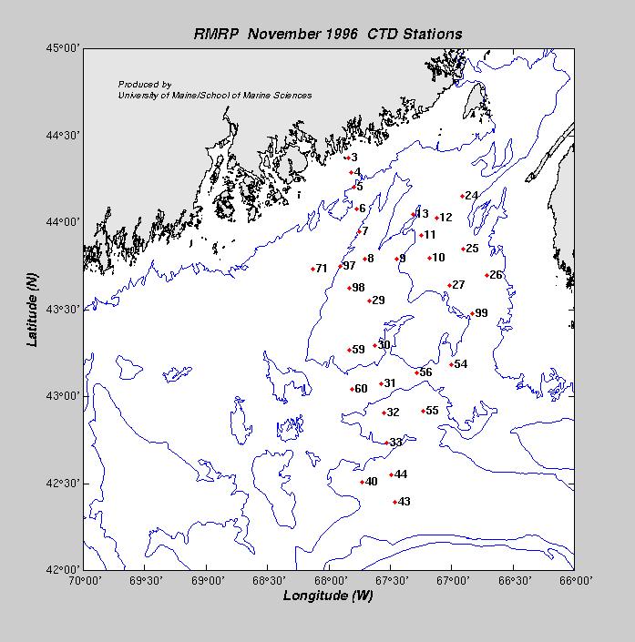
- November 3-10, 1996 (RV ARGO MAINE)
- Hydrography (32 stations):
CTD and
Nutrient Data
- COAS-3 moored recovered
- Bottom portions of TRUX-3 and JORD-3 recovered
Moorings
Description:
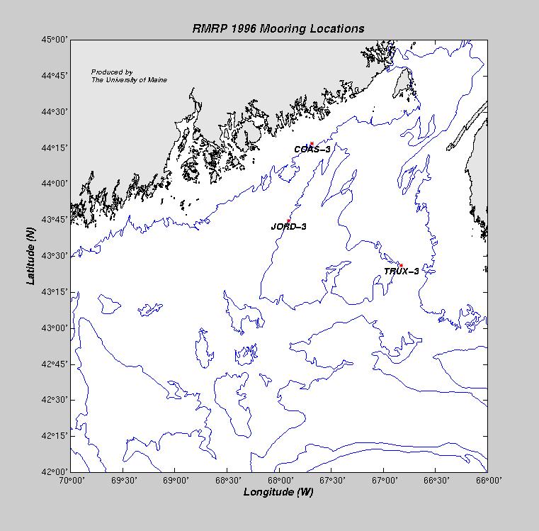
During 1996, the University of Maine deployed three inverse-catenary moorings, one within the 100 meter
isobath (COAS-3) and two within the 200 meter isobath (JORD-3 and TRUX-3). These
moorings were designed to sample the water column at discrete time intervals and
average the data to half-hourly values using 150 kHz ADCPs manufactured by
R.D. Instruments, Inc.
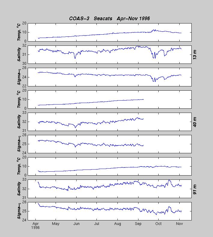
Seabird Seacat T/S instruments were attached
to the mooring wire near the surface at 3 depths on each mooring and sampled at
a rate of one sample every 5 minutes. COAS-3 seacats
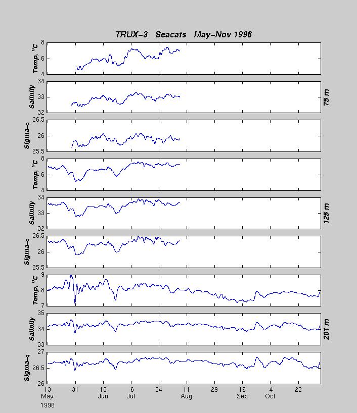
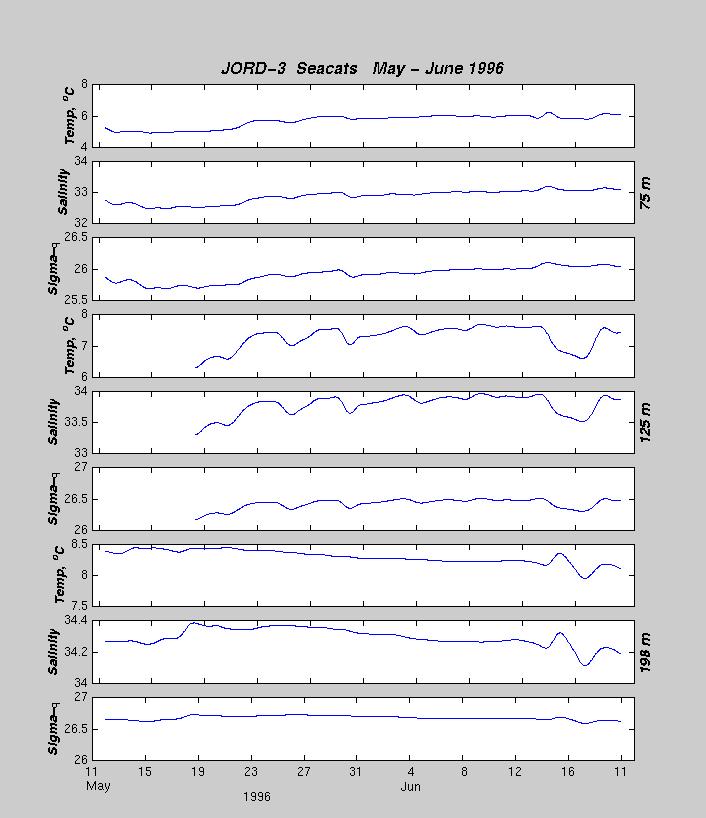
were attached at depths of 13, 40, and 91 meters. TRUX-3 and JORD-3 seacats were located
at 75, 125, and near 200 meters. The COAS-3 mooring was deployed on the RV
ARGO MAINE
in April 1996; the doppler failed in May 1996. The JORD-3 and TRUX-3 moorings were deployed in May 1996
and they were both trawled by fishing vessels in June and August 1996, which
caused the surface float to break free on each mooring. The surface floats were
recovered in July and September. The bottom portions of JORD-3 and TRUX-3 along with
the COAS-3 mooring were recovered in November 1996 by the RV
ARGO MAINE.
The mooring locations are as follows:
| BUOY |
Data |
Latitude |
Longitude |
Depth |
Deploy. Date |
Recov.Date |
Comments |
| COAS-3 |
Vel,T/S
|
44° 16.96´N |
067° 40.89´W |
94m |
03 Apr 1996 |
05 Nov 1996 |
Doppler failed May 96 |
| TRUX-3 |
Vel,T/S
|
43° 26.12´N |
066° 49.85´W |
193m |
11 May 1996 |
05 Nov 1996 |
Trawled by FV, float broke free |
| JORD-3 |
Vel,T/S
|
43° 44.626´N |
067° 54.37´W |
194 m |
10 May 1996 |
05 Nov 1996 |
Trawled by FV, float broke free |

